
Church Minshull topographic map
Interactive map
Click on the map to display elevation.
About this map
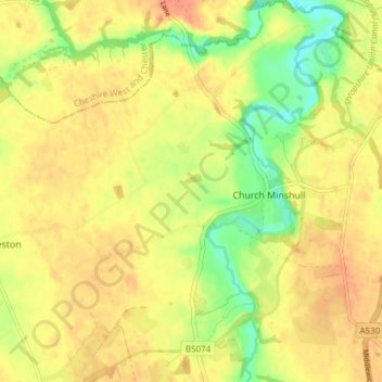
Name: Church Minshull topographic map, elevation, terrain.
Location: Church Minshull, Cheshire East, England, United Kingdom (53.11876 -2.54221 53.16427 -2.48397)
Average elevation: 45 m
Minimum elevation: 19 m
Maximum elevation: 60 m