Geolocate

Maite topographic map

Click on the map to display elevation.

About this map

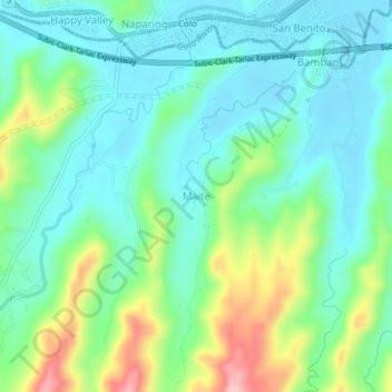
Name: Maite topographic map, elevation, terrain.

Location: Maite, Hermosa, Bataan, Central Luzon, 2111, Philippines (14.80927 120.39220 14.84927 120.43220)

Average elevation: 63 m

Minimum elevation: 13 m

Maximum elevation: 194 m

Gear up for your next adventure:

🗺️Ordnance Survey Maps - Official UK maps for walking and outdoor activities
🧭Emergency Beacons - Safety beacons for remote outdoor locations
Camping Shelters - Emergency and lightweight shelters for outdoor use
🚲Bikepacking Frame Bags - Storage for tools and navigation gear on long off-road rides
🧵Survival Paracord - Multi-purpose cordage for emergency repairs and shelters

As an Amazon Associate, this site earns from qualifying purchases at no extra cost to you.