
Make a donation
Gear up for your next adventure:
As an Amazon Associate, this site earns from qualifying purchases at no extra cost to you.
Nagar topographic map
Click on the map to display elevation.
Make a donation
Gear up for your next adventure:
As an Amazon Associate, this site earns from qualifying purchases at no extra cost to you.
Nagar
Brij Nagar is located at 27°25′29″N 77°05′58″E / 27.4247°N 77.09945°E / 27.4247; 77.09945. It has an average elevation of 201 metres (662 feet) from the sea level.
Make a donation
Gear up for your next adventure:
As an Amazon Associate, this site earns from qualifying purchases at no extra cost to you.
About this map
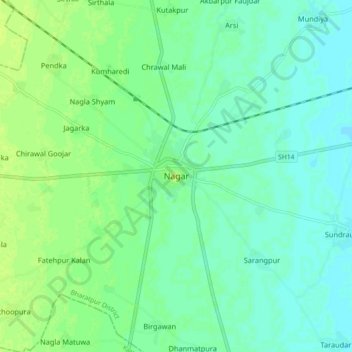
Name: Nagar topographic map, elevation, terrain.
Location: Nagar, Nagar Tehsil, Deeg, Rajasthan, 321205, India (27.38166 77.06041 27.46166 77.14041)
Average elevation: 202 m
Minimum elevation: 196 m
Maximum elevation: 209 m
Make a donation
Gear up for your next adventure:
As an Amazon Associate, this site earns from qualifying purchases at no extra cost to you.