Geolocate

Ranaghat topographic map

Click on the map to display elevation.

About this map
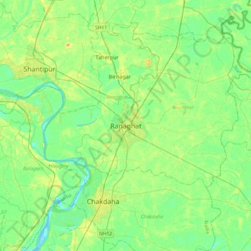
Name: Ranaghat topographic map, elevation, terrain.

Location: Ranaghat, Ranaghat - II, Nadia, West Bengal, 741200, India (23.01381 88.40368 23.33381 88.72368)

Average elevation: 10 m

Minimum elevation: -1 m

Maximum elevation: 28 m

Gear up for your next adventure:

🌄Outdoor Binoculars - Compact binoculars for landscape observation
👟Men's Trail Running Shoes - Lightweight grip for fast movement over topographic contours
🛌Sleeping Mats - Insulated mats for comfortable outdoor sleeping
📚UK Hiking Guidebooks - Detailed route descriptions for the Lake District, Peaks, and Highlands
🧥Breathable Waterproof Jackets - Essential rain protection for the unpredictable British climate

As an Amazon Associate, this site earns from qualifying purchases at no extra cost to you.