
Thank you for supporting this site ❤️
Make a donation
Make a donation
Gear up for your next adventure:
As an Amazon Associate, this site earns from qualifying purchases at no extra cost to you.
Puertollano topographic map
Click on the map to display elevation.
Thank you for supporting this site ❤️
Make a donation
Make a donation
Gear up for your next adventure:
As an Amazon Associate, this site earns from qualifying purchases at no extra cost to you.
About this map
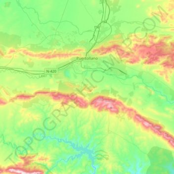
Name: Puertollano topographic map, elevation, terrain.
Location: Puertollano, Ciudad Real, Castile-La Mancha, 13500, Spain (38.57190 -4.26213 38.71112 -3.92701)
Average elevation: 720 m
Minimum elevation: 518 m
Maximum elevation: 1,157 m
Thank you for supporting this site ❤️
Make a donation
Make a donation
Gear up for your next adventure:
As an Amazon Associate, this site earns from qualifying purchases at no extra cost to you.