Geolocate

Tunggul Hill topographic map

Interactive map

Click on the map to display elevation.

About this map

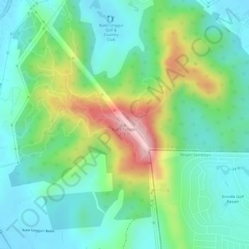
Name: Tunggul Hill topographic map, elevation, terrain.

Location: Tunggul Hill, Sepang, Selangor, 77188, Malaysia (2.87324 101.74848 2.87334 101.74858)

Average elevation: 93 m

Minimum elevation: 15 m

Maximum elevation: 254 m

Other topographic maps

Click on a map to view its topography, its elevation and its terrain.

Sungai Jenderam

Malaysia > Selangor > Sepang > Jenderam

Average elevation: 46 m

Obama Oval

Malaysia > Selangor > Sepang > Cyberjaya

Average elevation: 30 m

Cyberjaya

Malaysia > Selangor > Sepang

Average elevation: 24 m

Sungai Labu

Malaysia > Selangor > Sepang

Average elevation: 19 m

Putra Prima Playground

Malaysia > Selangor > Sepang

Average elevation: 7 m

Sungai Salak

Malaysia > Selangor > Sepang

Average elevation: 26 m