
Chơn Thành topographic map
Interactive map
Click on the map to display elevation.
About this map
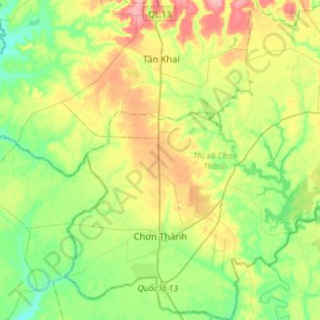
Name: Chơn Thành topographic map, elevation, terrain.
Location: Chơn Thành, Bình Phước Province, Vietnam (11.35375 106.53887 11.60681 106.77742)
Average elevation: 59 m
Minimum elevation: 20 m
Maximum elevation: 124 m
Other topographic maps
Click on a map to view its topography, its elevation and its terrain.