
Make a donation
Gear up for your next adventure:
As an Amazon Associate, this site earns from qualifying purchases at no extra cost to you.
Monte Solaro topographic map
Click on the map to display elevation.
Make a donation
Gear up for your next adventure:
As an Amazon Associate, this site earns from qualifying purchases at no extra cost to you.
Monte Solaro
Monte Solaro is a mountain on the island of Capri in Campania, Italy. With an elevation of 589 m, its peak is the highest point of Capri.
Make a donation
Gear up for your next adventure:
As an Amazon Associate, this site earns from qualifying purchases at no extra cost to you.
About this map
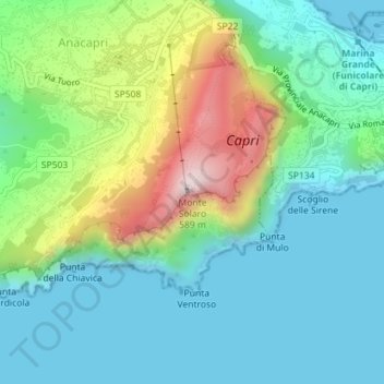
Name: Monte Solaro topographic map, elevation, terrain.
Location: Monte Solaro, Anacapri, Naples, Campania, 80071, Italy (40.54508 14.22369 40.54518 14.22379)
Average elevation: 155 m
Minimum elevation: -1 m
Maximum elevation: 570 m
Make a donation
Gear up for your next adventure:
As an Amazon Associate, this site earns from qualifying purchases at no extra cost to you.