Geolocate

Guiguinto topographic map

Click on the map to display elevation.

About this map

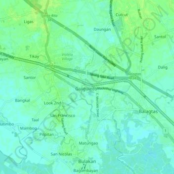
Name: Guiguinto topographic map, elevation, terrain.

Location: Guiguinto, Bulacan, Central Luzon, 3015, Philippines (14.78895 120.83929 14.86895 120.91929)

Average elevation: 5 m

Minimum elevation: 1 m

Maximum elevation: 11 m

Gear up for your next adventure:

🗺️Ordnance Survey Maps - Essential paper maps for hiking across the UK national parks
🍲Portable Camping Stoves - Fast-boiling stoves for hot meals on remote topographic survey trips
🧴Tick Removal Tools - Small, essential health tool for UK woodland and moorland
🪓Outdoor Multitools - Versatile tools for hiking and camping
🛑Emergency Bivvy Bags - Heat-reflective survival bags for unexpected nights out

As an Amazon Associate, this site earns from qualifying purchases at no extra cost to you.