Geolocate

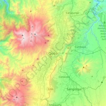
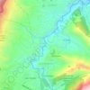
Quito topographic map

Click on the map to display elevation.

Quito

Quito (Spanish pronunciation: [ˈkito] (listen); Quechua: Kitu), formally San Francisco de Quito, is the capital and most populous city of Ecuador, with an estimated population of 2.8 million in its urban area. It is also the capital of the province of Pichincha. Quito is located in a valley on the eastern slopes of Pichincha, an active stratovolcano in the Andes, at an elevation of 2,850 m (9,350 ft), making it the second-highest capital city in the world.

Wikipedia (CC-BY-SA 3.0)

About this map

Name: Quito topographic map, elevation, terrain.

Location: Quito, Quito Canton, Pichincha, 170130, Ecuador (-0.38016 -78.67233 -0.06016 -78.35233)

Average elevation: 2,930 m

Minimum elevation: 1,897 m

Maximum elevation: 4,737 m

Other topographic maps

Click on a map to view its topography, its elevation and its terrain.

Secas

Ecuador > Pichincha > Quito Canton > Pintag

Average elevation: 3,567 m

Lloa

Ecuador > Pichincha > Quito Canton

Average elevation: 2,989 m

Pintag

Ecuador > Pichincha > Quito Canton

Average elevation: 3,471 m

Nanegalito

Ecuador > Pichincha > Quito Canton

Average elevation: 1,782 m

Tumbaco

Ecuador > Pichincha > Quito Canton

Average elevation: 2,499 m

Calacali

Ecuador > Pichincha > Quito Canton

Average elevation: 2,349 m

La Floresta

Ecuador > Pichincha > Quito Canton

Average elevation: 2,771 m

Guangopolo

Ecuador > Pichincha > Quito Canton

Average elevation: 2,496 m

Nono

Ecuador > Pichincha > Quito Canton

Average elevation: 2,875 m

Gear up for your next adventure:

🌄Compact Monoculars - Lightweight optics for hiking
🍳Camping Stoves - Compact stoves for outdoor cooking
🔦Keychain LED Torches - Emergency backup light for finding gear in your pack
🧭GPS Trackers - Tracking devices for safety and navigation
🔭Compact Hiking Binoculars - Lightweight optics for scouting terrain and spotting wildlife

As an Amazon Associate, this site earns from qualifying purchases at no extra cost to you.