Geolocate

Alton topographic map

Click on the map to display elevation.

About this map
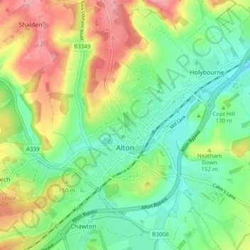
Name: Alton topographic map, elevation, terrain.

Location: Alton, Chawton, East Hampshire, Hampshire, England, United Kingdom (51.13176 -1.00676 51.17463 -0.93078)

Average elevation: 135 m

Minimum elevation: 90 m

Maximum elevation: 207 m

Hampshire trails, hiking, mountain biking, running and outdoor activities

Gear up for your next adventure:

⌚GPS Outdoor Watches - Watches with GPS tracking for hiking and exploration
🦶Anti-Blister Balms - Protect your feet before long topographic expeditions
🐕Hiking Dog Harnesses - Rugged harnesses for taking your companion on mountain trails
🧭Emergency Beacons - Safety beacons for remote outdoor locations
🔦Waterproof LED Headlamps - Hands-free lighting for evening treks and emergency navigation

As an Amazon Associate, this site earns from qualifying purchases at no extra cost to you.