
Ζευγολατιό topographic map
Interactive map
Click on the map to display elevation.
Ζευγολατιό
Zevgolateio (Greek: Ζευγολατείο) is a village and a community in the municipal unit of Korythio, Arcadia, Greece. The community includes the small village Parori. It is situated at the eastern edge of the plain of Tripoli, at about 650 m elevation. Zevgolateio is 2 km southeast of Pelagos, 3 km northwest of Steno and 6 km east of Tripoli.
About this map
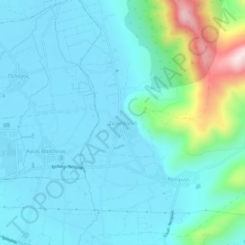
Name: Ζευγολατιό topographic map, elevation, terrain.
Average elevation: 724 m
Minimum elevation: 639 m
Maximum elevation: 1,157 m