Geolocate

La Rioja topographic map

Click on the map to display elevation.

About this map
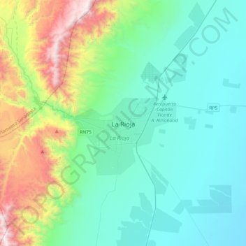
Name: La Rioja topographic map, elevation, terrain.

Location: La Rioja, Departamento Capital, La Rioja, F5300, Argentina (-29.57274 -67.01588 -29.25274 -66.69588)

Average elevation: 777 m

Minimum elevation: 348 m

Maximum elevation: 2,345 m

Other topographic maps

Click on a map to view its topography, its elevation and its terrain.
Departamento Vinchina

Argentina > La Rioja

Average elevation: 3,528 m

Gear up for your next adventure:

🔦LED Camping Lanterns - Illumination for reading maps inside your tent at night
🪢Paracord - Multi-purpose cord for camping and survival
🧭Professional Hiking Compasses - High-precision liquid-filled compasses for map reading and orientation
📍Handheld GPS Navigators - Reliable satellite navigation for hiking and off-road exploration
🐕Dog Hiking Gear - Equipment for hiking safely with dogs

As an Amazon Associate, this site earns from qualifying purchases at no extra cost to you.