
Make a donation
Gear up for your next adventure:
As an Amazon Associate, this site earns from qualifying purchases at no extra cost to you.
Periyapanicheri topographic map
Click on the map to display elevation.
Gear up for your next adventure:
As an Amazon Associate, this site earns from qualifying purchases at no extra cost to you.
About this map
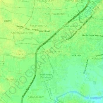
Name: Periyapanicheri topographic map, elevation, terrain.
Location: Periyapanicheri, Alandur, Chennai, Tamil Nadu, 600122, India (12.99240 80.11361 13.03240 80.15361)
Average elevation: 16 m
Minimum elevation: 6 m
Maximum elevation: 21 m
Make a donation
Gear up for your next adventure:
As an Amazon Associate, this site earns from qualifying purchases at no extra cost to you.
Other topographic maps
Click on a map to view its topography, its elevation and its terrain.
Make a donation
Gear up for your next adventure:
As an Amazon Associate, this site earns from qualifying purchases at no extra cost to you.
Make a donation
Gear up for your next adventure:
As an Amazon Associate, this site earns from qualifying purchases at no extra cost to you.