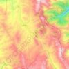
KhalKhal topographic map
Click on the map to display elevation.
About this map

Name: KhalKhal topographic map, elevation, terrain.
Location: KhalKhal, بخش مرکزی, Kahlkhal County, Ardabil Province, Iran (37.60040 48.50226 37.63831 48.55082)
Average elevation: 1,836 m
Minimum elevation: 1,757 m
Maximum elevation: 2,025 m
Other topographic maps
Click on a map to view its topography, its elevation and its terrain.
Alhashem-e Olya
Iran > Ardabil Province > Kahlkhal County > دهستان خانندبیل شرقی
Average elevation: 2,131 m