Geolocate

Neukirchen topographic map

Click on the map to display elevation.

About this map
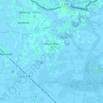
Name: Neukirchen topographic map, elevation, terrain.

Location: Neukirchen, Südtondern, Northern Friesland, Schleswig-Holstein, 25927, Germany (54.83902 8.69030 54.88746 8.81589)

Average elevation: 0 m

Minimum elevation: -5 m

Maximum elevation: 6 m

Other topographic maps

Click on a map to view its topography, its elevation and its terrain.
Gear up for your next adventure:

🧴Sport Sunscreen Sticks - High-protection sunblock that won't run into your eyes on the trail
🚲Bikepacking Frame Bags - Storage for tools and navigation gear on long off-road rides
🧤Waterproof Overmitts - Extreme weather protection for hikers and mountaineers
🛰️Outdoor GPS Navigation - Navigation devices for remote and off-grid areas
🔥Reusable Hand Warmers - Maintain dexterity in your fingers for precise map handling

As an Amazon Associate, this site earns from qualifying purchases at no extra cost to you.