

Bayda topographic map
Click on the map to display elevation.
Bayda
The city of Bayda has a mild Mediterranean climate (Csb, according to the Köppen climate classification) with an average annual precipitation of 540 millimetres or 21 inches. It is famous for recurring snow falls and heavy rains, where the temperature rises in the summer time to 30 °C (86 °F), but in the winter snow and freezing temperatures can occur. The city is in a Mediterranean-Berber/Arab area about 241 kilometres (150 mi) south of Crete, and is referred to as the City of Snow, which distinguishes it from the rest of the cities of Libya. The altitude added to the northern location sustains the nival precipitation (even if hardly accumulates), different from other nearby coastal areas. The region of Jabal al-Akhda is characterized by a moderate climate, being cooler in the winter with an average annual rainfall of about 540 millimetres or 21 inches.
About this map
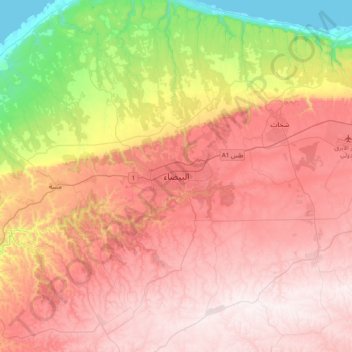
Name: Bayda topographic map, elevation, terrain.
Location: Bayda, Jabal al Akhdar, Libya (32.60095 21.59772 32.92095 21.91772)
Average elevation: 504 m
Minimum elevation: 0 m
Maximum elevation: 878 m
Other topographic maps
Click on a map to view its topography, its elevation and its terrain.

