
Thank you for supporting this site ❤️
Make a donation
Make a donation
Gear up for your next adventure:
As an Amazon Associate, this site earns from qualifying purchases at no extra cost to you.
Habichtswald topographic map
Click on the map to display elevation.
Thank you for supporting this site ❤️
Make a donation
Make a donation
Gear up for your next adventure:
As an Amazon Associate, this site earns from qualifying purchases at no extra cost to you.
About this map
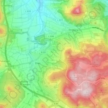
Name: Habichtswald topographic map, elevation, terrain.
Location: Habichtswald, Landkreis Kassel, Hessen, 34317, Duitsland (51.29736 9.28344 51.35982 9.38198)
Average elevation: 411 m
Minimum elevation: 266 m
Maximum elevation: 620 m
Thank you for supporting this site ❤️
Make a donation
Make a donation
Gear up for your next adventure:
As an Amazon Associate, this site earns from qualifying purchases at no extra cost to you.