Geolocate

Bagumbong topographic map

Click on the map to display elevation.

About this map

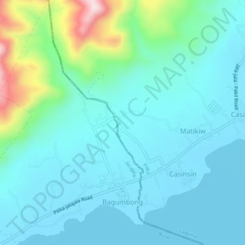
Name: Bagumbong topographic map, elevation, terrain.

Location: Bagumbong, Jalajala, Rizal, Calabarzon, 1990, Philippines (14.33415 121.35177 14.37209 121.38053)

Average elevation: 71 m

Minimum elevation: -1 m

Maximum elevation: 393 m

Gear up for your next adventure:

🧤Waterproof Overmitts - Extreme weather protection for hikers and mountaineers
🥄Titanium Camping Sporks - The ultimate lightweight utensil for trail meals
🌦️Portable Weather Meters - Handheld tools for monitoring weather conditions
🚲Bikepacking Frame Bags - Storage for tools and navigation gear on long off-road rides
🥾Hiking Boots - Waterproof and durable boots for long-distance hiking in the UK

As an Amazon Associate, this site earns from qualifying purchases at no extra cost to you.