
Xã Đức Hòa Hạ topographic map
Interactive map
Click on the map to display elevation.
About this map
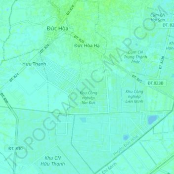
Name: Xã Đức Hòa Hạ topographic map, elevation, terrain.
Location: Xã Đức Hòa Hạ, Đức Hòa District, Long An Province, Vietnam (10.76300 106.44931 10.83409 106.50565)
Average elevation: 3 m
Minimum elevation: 0 m
Maximum elevation: 8 m
Other topographic maps
Click on a map to view its topography, its elevation and its terrain.