
Thank you for supporting this site ❤️
Make a donation
Make a donation
Gear up for your next adventure:
As an Amazon Associate, this site earns from qualifying purchases at no extra cost to you.
Olvera topographic map
Click on the map to display elevation.
Thank you for supporting this site ❤️
Make a donation
Make a donation
Gear up for your next adventure:
As an Amazon Associate, this site earns from qualifying purchases at no extra cost to you.
About this map
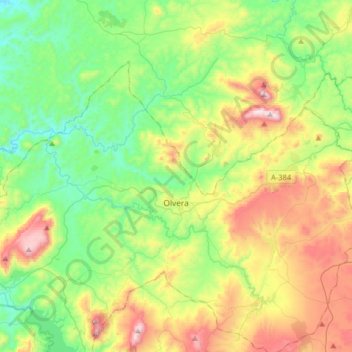
Name: Olvera topographic map, elevation, terrain.
Location: Olvera, Sierra de Cádiz, Cádiz, Andalusia, 11690, Spain (36.87017 -5.41788 37.03736 -5.09569)
Average elevation: 517 m
Minimum elevation: 205 m
Maximum elevation: 1,114 m
Thank you for supporting this site ❤️
Make a donation
Make a donation
Gear up for your next adventure:
As an Amazon Associate, this site earns from qualifying purchases at no extra cost to you.