Geolocate

Ponda topographic map

Click on the map to display elevation.

About this map

Name: Ponda topographic map, elevation, terrain.

Location: Ponda, South Goa, Goa, 403401, India (15.37638 73.98238 15.41891 74.03991)

Average elevation: 62 m

Minimum elevation: 0 m

Maximum elevation: 212 m

Other topographic maps

Click on a map to view its topography, its elevation and its terrain.
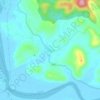
Shiroda

India > Goa > Ponda

Average elevation: 33 m

Gear up for your next adventure:

👟Waterproof Leg Gaiters - Keep mud and water out of your boots in boggy terrain
🧭Orienteering Compasses - Accurate compasses for map-based navigation
📐Altimeters & Barometers - Tools for measuring altitude and air pressure
⛺Lightweight Solo Tents - Backpacking tents designed for wild camping in the UK highlands
👟Heavy Duty Boot Laces - Always carry a spare for your hiking footwear

As an Amazon Associate, this site earns from qualifying purchases at no extra cost to you.