Geolocate

Droxford topographic map

Click on the map to display elevation.

About this map
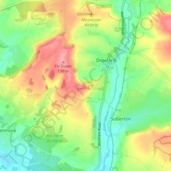
Name: Droxford topographic map, elevation, terrain.

Location: Droxford, Winchester, Hampshire, England, United Kingdom (50.93355 -1.17995 50.97764 -1.12850)

Average elevation: 81 m

Minimum elevation: 37 m

Maximum elevation: 142 m

Hampshire trails, hiking, mountain biking, running and outdoor activities

Gear up for your next adventure:

🧵Survival Paracord - Multi-purpose cordage for emergency repairs and shelters
📷Outdoor Action Cameras - Cameras designed for hiking and adventure
🧥Softshell Jackets - Breathable jackets for active outdoor use
🥤Hiking Water Bottles - Reusable bottles for hydration on the trail
👟Heavy Duty Boot Laces - Always carry a spare for your hiking footwear

As an Amazon Associate, this site earns from qualifying purchases at no extra cost to you.