
Tordesillas topographic map
Interactive map
Click on the map to display elevation.
About this map
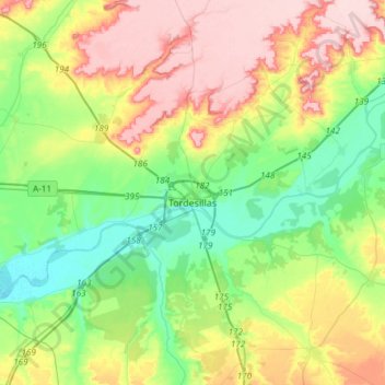
Name: Tordesillas topographic map, elevation, terrain.
Location: Tordesillas, Valladolid, Castile and León, Spain (41.45174 -5.15666 41.56136 -4.85842)
Average elevation: 733 m
Minimum elevation: 659 m
Maximum elevation: 845 m
Tordesillas (Spanish pronunciation: ) is a town and municipality in the province of Valladolid, Castile and León, central Spain. It is located 25 kilometres (16 mi) southwest of the provincial capital, Valladolid at an elevation of 704 metres (2,310 ft). The population was c. 9,000 as of 2009.