Geolocate

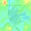
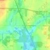
Deerfield topographic map

Click on the map to display elevation.

About this map
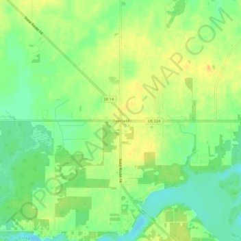
Name: Deerfield topographic map, elevation, terrain.

Location: Deerfield, Deerfield Township, Portage County, Ohio, 44411, United States (41.00469 -81.07032 41.04469 -81.03032)

Average elevation: 321 m

Minimum elevation: 305 m

Maximum elevation: 334 m

Other topographic maps

Click on a map to view its topography, its elevation and its terrain.
Ravenna

United States > Ohio > Portage County

Average elevation: 336 m

Wingfoot Lake

United States > Ohio > Portage County > Suffield > Mishler

Average elevation: 354 m

Streetsboro

United States > Ohio > Portage County

Average elevation: 335 m

Kent

United States > Ohio > Portage County

Located on the western end of the Glaciated Allegheny Plateau, the topography of Kent includes rolling hills and varied terrain. The Cuyahoga River passes through the city, cutting a gorge with a drop of nearly 40 feet (10 m) adjacent to the downtown area. The United States Geological Survey lists the city's…

Average elevation: 328 m
Mantua

United States > Ohio > Portage County

Average elevation: 350 m

Rootstown Township

United States > Ohio > Portage County

Average elevation: 338 m

Hiram Township

United States > Ohio > Portage County

Average elevation: 354 m

Ravenna Township

United States > Ohio > Portage County

Average elevation: 334 m

Mantua Township

United States > Ohio > Portage County

Average elevation: 358 m

Atwater

United States > Ohio > Portage County > Atwater

Average elevation: 346 m

Sugar Bush Knolls

United States > Ohio > Portage County

Average elevation: 331 m

Windham

United States > Ohio > Portage County

Average elevation: 297 m

Aurora

United States > Ohio > Portage County

Average elevation: 335 m

Aurora

United States > Ohio > Portage County

Average elevation: 335 m

Kent

United States > Ohio > Portage County

Located on the western end of the Glaciated Allegheny Plateau, the topography of Kent includes rolling hills and varied terrain. The Cuyahoga River passes through the city, cutting a gorge with a drop of nearly 40 feet (10 m) adjacent to the downtown area. The United States Geological Survey lists the city's…

Average elevation: 328 m
Aurora

United States > Ohio > Portage County

Average elevation: 335 m

Randolph Township

United States > Ohio > Portage County

Average elevation: 353 m

Windham Township

United States > Ohio > Portage County

Average elevation: 315 m

Kent

United States > Ohio > Portage County

Located on the western end of the Glaciated Allegheny Plateau, the topography of Kent includes rolling hills and varied terrain. The Cuyahoga River passes through the city, cutting a gorge with a drop of nearly 40 feet (10 m) adjacent to the downtown area. The United States Geological Survey lists the city's…

Average elevation: 328 m

Rootstown Township

United States > Ohio > Portage County

Average elevation: 338 m

Atwater

United States > Ohio > Portage County > Atwater

Average elevation: 346 m

Kent

United States > Ohio > Portage County

Located on the western end of the Glaciated Allegheny Plateau, the topography of Kent includes rolling hills and varied terrain. The Cuyahoga River passes through the city, cutting a gorge with a drop of nearly 40 feet (10 m) adjacent to the downtown area. The United States Geological Survey lists the city's…

Average elevation: 328 m
Gear up for your next adventure:

🧷Tenacious Repair Tape - Instant fix for torn tents, jackets, or dry bags
🛰️Handheld GPS Devices - Reliable GPS units for hiking and outdoor navigation
👟Women's Trail Running Shoes - Agile footwear for fell running and technical trails
📦Compression Sacks - Reduce backpack volume efficiently
🎒Replacement Sternum Straps - Repair parts for hiking rucksacks

As an Amazon Associate, this site earns from qualifying purchases at no extra cost to you.