
Thank you for supporting this site ❤️
Make a donation
Make a donation
Gear up for your next adventure:
As an Amazon Associate, this site earns from qualifying purchases at no extra cost to you.
Santpedor topographic map
Click on the map to display elevation.
Thank you for supporting this site ❤️
Make a donation
Make a donation
Gear up for your next adventure:
As an Amazon Associate, this site earns from qualifying purchases at no extra cost to you.
About this map
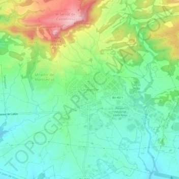
Name: Santpedor topographic map, elevation, terrain.
Location: Santpedor, Bages, Barcelona, Catalonia, 08251, Spain (41.76476 1.81869 41.80476 1.85869)
Average elevation: 335 m
Minimum elevation: 263 m
Maximum elevation: 486 m
Thank you for supporting this site ❤️
Make a donation
Make a donation
Gear up for your next adventure:
As an Amazon Associate, this site earns from qualifying purchases at no extra cost to you.