
Yamdena Island topographic map
Interactive map
Click on the map to display elevation.
About this map
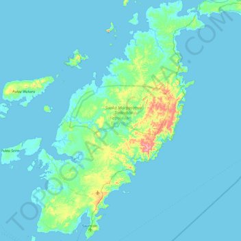
Name: Yamdena Island topographic map, elevation, terrain.
Location: Yamdena Island, Kepulauan Tanimbar, Moluccas, Indonesia (-8.03093 131.07872 -7.11728 131.74670)
Average elevation: 20 m
Minimum elevation: -1 m
Maximum elevation: 304 m