
Serra da Freita topographic map
Interactive map
Click on the map to display elevation.
About this map
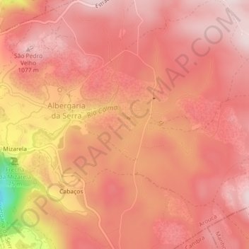
Name: Serra da Freita topographic map, elevation, terrain.
Location: Serra da Freita, Arouca, Aveiro, 4540-013, Portugal (40.86693 -8.26699 40.86703 -8.26689)
Average elevation: 982 m
Minimum elevation: 677 m
Maximum elevation: 1,081 m
Other topographic maps
Click on a map to view its topography, its elevation and its terrain.
Rio de Frades
Portugal > Aveiro > Arouca > Tebilhão
Rio de Frades, Tebilhão, Cabreiros e Albergaria da Serra, Arouca, Aveiro, 3660-137, Portugal
Average elevation: 664 m