Geolocate

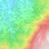
Mesquitela topographic map

Click on the map to display elevation.

About this map

Name: Mesquitela topographic map, elevation, terrain.

Location: Mesquitela, Celorico da Beira, Guarda, 6360-102, Portugal (40.56528 -7.50328 40.60609 -7.44297)

Average elevation: 471 m

Minimum elevation: 377 m

Maximum elevation: 586 m

Other topographic maps

Click on a map to view its topography, its elevation and its terrain.
Aldeia da Serra

Portugal > Guarda > Celorico da Beira

Average elevation: 575 m

Linhares

Portugal > Guarda > Celorico da Beira

Average elevation: 798 m

Aldeia da Serra

Portugal > Guarda > Celorico da Beira

Average elevation: 575 m

Gear up for your next adventure:

⛺Lightweight Tents - Compact tents for backpacking and trekking
🧺Microfibre Travel Towels - Fast-drying and compact towels for wild swimming and camping
🧭Emergency Beacons - Safety beacons for remote outdoor locations
📻Hand-Crank Emergency Radios - Stay updated on weather warnings in remote areas
🔥Emergency Fire Starters - Reliable ignition tools for survival situations in damp conditions

As an Amazon Associate, this site earns from qualifying purchases at no extra cost to you.