Geolocate

Magalang topographic map

Click on the map to display elevation.

About this map

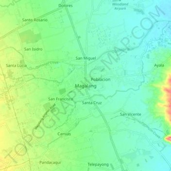
Name: Magalang topographic map, elevation, terrain.

Location: Magalang, Pampanga, Central Luzon, 2011, Philippines (15.17393 120.62181 15.25393 120.70181)

Average elevation: 44 m

Minimum elevation: 20 m

Maximum elevation: 103 m

Gear up for your next adventure:

🛰️Outdoor GPS Navigation - Navigation devices for remote and off-grid areas
🎒Hiking Daypacks - Compact backpacks ideal for short hikes and excursions
🧤Hiking Gloves - Warm and durable gloves for cold-weather walks
🥤Hiking Water Bottles - Reusable bottles for hydration on the trail
Lightweight Tents - Compact tents for backpacking and trekking

As an Amazon Associate, this site earns from qualifying purchases at no extra cost to you.