Geolocate

Kadi topographic map

Click on the map to display elevation.

About this map

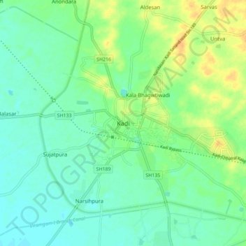
Name: Kadi topographic map, elevation, terrain.

Location: Kadi, Kadi Taluka, Mahesana District, Gujarat, 382715, India (23.25694 72.29064 23.33694 72.37064)

Average elevation: 62 m

Minimum elevation: 52 m

Maximum elevation: 80 m

Gear up for your next adventure:

🛑Emergency Bivvy Bags - Heat-reflective survival bags for unexpected nights out
🧢Hiking Hats - Sun and weather protection for outdoor walks
📕Outdoor Navigation Books - Learn traditional and modern navigation techniques
🧼Camping Hygiene Kits - Compact hygiene essentials for outdoor stays
🗺️Ordnance Survey Maps - Essential paper maps for hiking across the UK national parks

As an Amazon Associate, this site earns from qualifying purchases at no extra cost to you.