Geolocate

Altadena topographic map

Click on the map to display elevation.

About this map
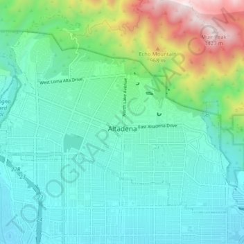
Name: Altadena topographic map, elevation, terrain.

Location: Altadena, Los Angeles County, California, United States (34.16757 -118.17179 34.21875 -118.09494)

Average elevation: 503 m

Minimum elevation: 245 m

Maximum elevation: 1,441 m

Gear up for your next adventure:

🎒Multi-day Trekking Packs - Large capacity backpacks for wild camping and long-distance trails
📱Phone Mounts for Hiking - Secure mounts to carry your phone on trails
🔦LED Camping Lanterns - Illumination for reading maps inside your tent at night
🚲Bikepacking Frame Bags - Storage for tools and navigation gear on long off-road rides
👖Convertible Hiking Trousers - Versatile zip-off pants for changing mountain weather conditions

As an Amazon Associate, this site earns from qualifying purchases at no extra cost to you.