
Tanalt topographic map
Interactive map
Click on the map to display elevation.
About this map
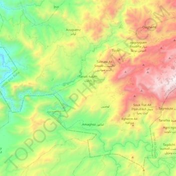
Name: Tanalt topographic map, elevation, terrain.
Average elevation: 1,027 m
Minimum elevation: 214 m
Maximum elevation: 2,230 m
Other topographic maps
Click on a map to view its topography, its elevation and its terrain.
Aït Mhand أيت محند
Aït Mhand أيت محند, Ait Ouadrim, caïdat d'Aït Ouadrim, cercle d'Aït Baha, Chtouka-Ait Baha Province, Souss-Massa, Morocco
Average elevation: 495 m