
Thank you for supporting this site ❤️
Make a donation
Make a donation
Gear up for your next adventure:
As an Amazon Associate, this site earns from qualifying purchases at no extra cost to you.
Bageshwar topographic map
Click on the map to display elevation.
Thank you for supporting this site ❤️
Make a donation
Make a donation
Gear up for your next adventure:
As an Amazon Associate, this site earns from qualifying purchases at no extra cost to you.
About this map
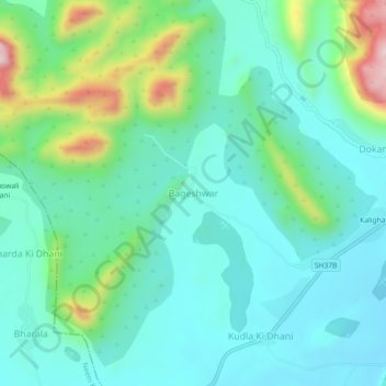
Name: Bageshwar topographic map, elevation, terrain.
Location: Bageshwar, Patan Tehsil, Sikar, Rajasthan, India (27.75147 75.87894 27.79147 75.91894)
Average elevation: 484 m
Minimum elevation: 392 m
Maximum elevation: 783 m
Thank you for supporting this site ❤️
Make a donation
Make a donation
Gear up for your next adventure:
As an Amazon Associate, this site earns from qualifying purchases at no extra cost to you.