
Gemeinde Hollabrunn topographic map
Interactive map
Click on the map to display elevation.
About this map
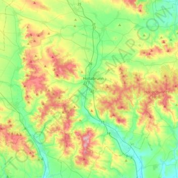
Name: Gemeinde Hollabrunn topographic map, elevation, terrain.
Location: Gemeinde Hollabrunn, Bezirk Hollabrunn, Lower Austria, Austria (48.48875 15.96145 48.60891 16.30427)
Average elevation: 267 m
Minimum elevation: 186 m
Maximum elevation: 410 m
Other topographic maps
Click on a map to view its topography, its elevation and its terrain.
Hardegg
Austria > Lower Austria > Bezirk Hollabrunn > Gemeinde Hardegg
Hardegg, Gemeinde Hardegg, Bezirk Hollabrunn, Lower Austria, 2082, Austria
Average elevation: 388 m