
Forest Hills topographic map
Interactive map
Click on the map to display elevation.
About this map
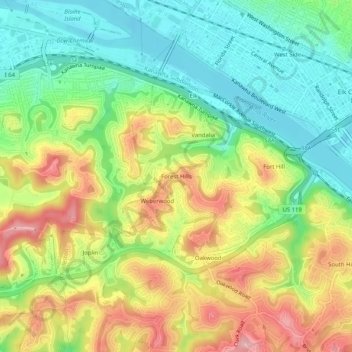
Name: Forest Hills topographic map, elevation, terrain.
Average elevation: 240 m
Minimum elevation: 172 m
Maximum elevation: 332 m
Other topographic maps
Click on a map to view its topography, its elevation and its terrain.
East Side
United States > West Virginia > Kanawha County > Charleston
East Side, Charleston, Kanawha County, West Virginia, 25389, United States
Average elevation: 222 m
Loudon Heights
United States > West Virginia > Kanawha County > Charleston
Loudon Heights, Charleston, Kanawha County, West Virginia, 25301, United States
Average elevation: 264 m