
Al-Khidhir District topographic map
Interactive map
Click on the map to display elevation.
About this map
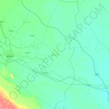
Name: Al-Khidhir District topographic map, elevation, terrain.
Location: Al-Khidhir District, Al-Muthanna Governorate, 91119, Iraq (30.96363 45.25826 31.66692 45.80302)
Average elevation: 11 m
Minimum elevation: 4 m
Maximum elevation: 68 m
Other topographic maps
Click on a map to view its topography, its elevation and its terrain.
Busayyah Subdistrict
Iraq > Al-Muthanna Governorate
Busayyah Subdistrict, Al-Salman District, Al-Muthanna Governorate, 90009, Iraq
Average elevation: 163 m
Al-Khidhir Central Subdistrict
Iraq > Al-Muthanna Governorate
Al-Khidhir Central Subdistrict, Al-Khidhir District, Al-Muthanna Governorate, Iraq
Average elevation: 12 m