
Williamsport topographic map
Interactive map
Click on the map to display elevation.
About this map
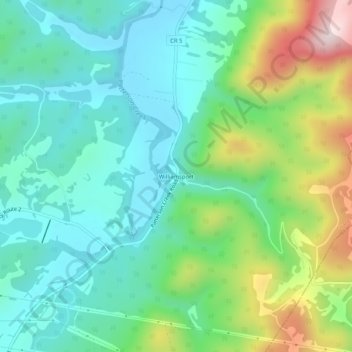
Name: Williamsport topographic map, elevation, terrain.
Location: Williamsport, Grant County, West Virginia, United States (39.18149 -79.04809 39.22149 -79.00809)
Average elevation: 419 m
Minimum elevation: 272 m
Maximum elevation: 795 m
Other topographic maps
Click on a map to view its topography, its elevation and its terrain.
Mount Storm
United States > West Virginia > Grant County
Mount Storm, Grant County, West Virginia, 26739, United States
Average elevation: 834 m