
Eggington topographic map
Interactive map
Click on the map to display elevation.
About this map
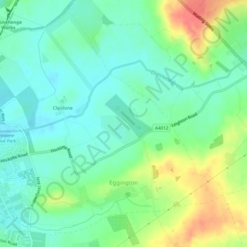
Name: Eggington topographic map, elevation, terrain.
Location: Eggington, Central Bedfordshire, England, United Kingdom (51.91200 -0.63859 51.93815 -0.59187)
Average elevation: 106 m
Minimum elevation: 88 m
Maximum elevation: 140 m
Other topographic maps
Click on a map to view its topography, its elevation and its terrain.
Clipstone
United Kingdom > England > Central Bedfordshire > Eggington
Clipstone, Eggington, Central Bedfordshire, England, LU7 9NZ, United Kingdom
Average elevation: 105 m