
Lázaro Cárdenas topographic map
Interactive map
Click on the map to display elevation.
About this map
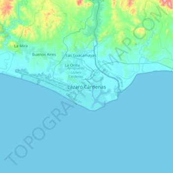
Name: Lázaro Cárdenas topographic map, elevation, terrain.
Location: Lázaro Cárdenas, Michoacán, 60950, Mexico (17.79948 -102.35866 18.11948 -102.03866)
Average elevation: 42 m
Minimum elevation: -1 m
Maximum elevation: 549 m