
Caryville topographic map
Interactive map
Click on the map to display elevation.
About this map
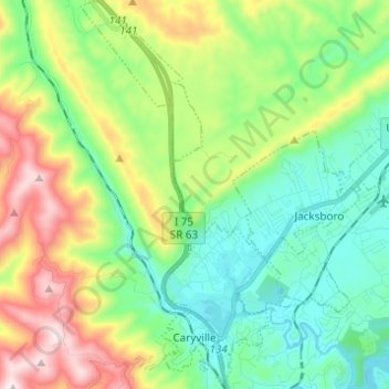
Name: Caryville topographic map, elevation, terrain.
Average elevation: 515 m
Minimum elevation: 298 m
Maximum elevation: 973 m
Other topographic maps
Click on a map to view its topography, its elevation and its terrain.
Pioneer
United States > Tennessee > Campbell County
Pioneer, Campbell County, Tennessee, 37847, United States
Average elevation: 576 m
LaFollette
United States > Tennessee > Campbell County > LaFollette
LaFollette, La Follette, Campbell County, Tennessee, 37766, United States
Average elevation: 435 m