Geolocate

Kerrera topographic map

Click on the map to display elevation.

About this map
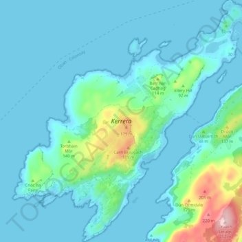
Name: Kerrera topographic map, elevation, terrain.

Location: Kerrera, Oban, Argyll and Bute, Scotland, PA34 4SX, United Kingdom (56.37033 -5.58904 56.42565 -5.49024)

Average elevation: 34 m

Minimum elevation: 0 m

Maximum elevation: 245 m

Argyll and Bute trails, hiking, mountain biking, running and outdoor activities

Gear up for your next adventure:

🦶Anti-Blister Balms - Protect your feet before long topographic expeditions
☕Insulated Travel Mugs - Keep drinks hot while surveying the landscape from a summit
🛰️Satellite Messengers - Emergency communication devices for areas without mobile signal
🌄Outdoor Binoculars - Compact binoculars for landscape observation
🔦LED Camping Lanterns - Illumination for reading maps inside your tent at night

As an Amazon Associate, this site earns from qualifying purchases at no extra cost to you.