
Leverkusen topographic map
Interactive map
Click on the map to display elevation.
About this map
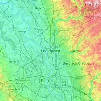
Name: Leverkusen topographic map, elevation, terrain.
Location: Leverkusen, North Rhine-Westphalia, 51373, Germany (50.87247 6.82812 51.19247 7.14812)
Average elevation: 98 m
Minimum elevation: 24 m
Maximum elevation: 380 m