Geolocate

Dolomite topographic map

Click on the map to display elevation.

About this map
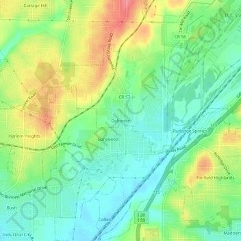
Name: Dolomite topographic map, elevation, terrain.

Location: Dolomite, Birmingham, Jefferson County, Alabama, 35061, United States (33.44289 -86.98138 33.48289 -86.94138)

Average elevation: 176 m

Minimum elevation: 145 m

Maximum elevation: 224 m

Other topographic maps

Click on a map to view its topography, its elevation and its terrain.
Gear up for your next adventure:

🎒Replacement Sternum Straps - Repair parts for hiking rucksacks
🗺️Scratch-off Peak Maps - Track your progress climbing Munros or Wainwrights
🕶️Glacier Goggles - Maximum protection for high-altitude snow topography
🎒Backpack Rain Covers - Universal waterproof covers to protect your gear from downpours
🧤Waterproof Overmitts - Extreme weather protection for hikers and mountaineers

As an Amazon Associate, this site earns from qualifying purchases at no extra cost to you.