Geolocate

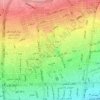
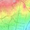
Hesarak topographic map

Click on the map to display elevation.

About this map

Name: Hesarak topographic map, elevation, terrain.

Location: Hesarak, District 5, Tehran, بخش مرکزی شهرستان تهران, Tehran County, Tehran Province, Iran (35.77474 51.29892 35.79034 51.32535)

Average elevation: 1,674 m

Minimum elevation: 1,496 m

Maximum elevation: 2,083 m

Other topographic maps

Click on a map to view its topography, its elevation and its terrain.
Pardis

Iran > Tehran County > Tehran

Average elevation: 1,336 m

رود فرحزاد

Iran > Tehran County > Tehran

Average elevation: 1,509 m

Park-e Shahr

Iran > Tehran County > Tehran

Average elevation: 1,156 m

Kan

Iran > Tehran County > Tehran

Average elevation: 1,428 m

Mellat Park

Iran > Tehran County > Tehran

Average elevation: 1,528 m

Gear up for your next adventure:

🧊Personal Water Filters - Drink safely from mountain streams marked on your map
🌂Windproof Trekking Umbrellas - Surprising but effective rain protection on low-wind trails
🧭Emergency Beacons - Safety beacons for remote outdoor locations
🐕Hiking Dog Harnesses - Rugged harnesses for taking your companion on mountain trails
🔦Outdoor Torches - Reliable torches for night navigation

As an Amazon Associate, this site earns from qualifying purchases at no extra cost to you.