Geolocate

Braughing topographic map

Click on the map to display elevation.

About this map
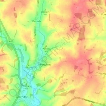
Name: Braughing topographic map, elevation, terrain.

Location: Braughing, East Hertfordshire, Hertfordshire, England, United Kingdom (51.88989 -0.01586 51.93373 0.06616)

Average elevation: 104 m

Minimum elevation: 63 m

Maximum elevation: 134 m

Hertfordshire trails, hiking, mountain biking, running and outdoor activities

Gear up for your next adventure:

👖Hiking Trousers - Durable trousers designed for rough terrain
🕶️Glacier Goggles - Maximum protection for high-altitude snow topography
📍Handheld GPS Navigators - Reliable satellite navigation for hiking and off-road exploration
🔋Lithium AA Batteries - Long-lasting power that performs well in cold mountain weather
🧢Thermal Beanie Hats - Prevent heat loss from the head in windy summit conditions

As an Amazon Associate, this site earns from qualifying purchases at no extra cost to you.