Geolocate

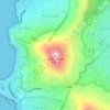
Princess Vlei topographic map

Click on the map to display elevation.

About this map
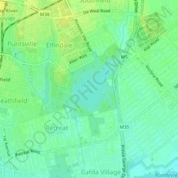
Name: Princess Vlei topographic map, elevation, terrain.

Location: Princess Vlei, Cape Town Ward 72, Cape Town, City of Cape Town, Western Cape, South Africa (-34.05126 18.47961 -34.04521 18.48630)

Average elevation: 12 m

Minimum elevation: 3 m

Maximum elevation: 21 m

Other topographic maps

Click on a map to view its topography, its elevation and its terrain.
8001

South Africa > Western Cape > City of Cape Town > Cape Town

Average elevation: 102 m

Gear up for your next adventure:

⛺Lightweight Solo Tents - Backpacking tents designed for wild camping in the UK highlands
🔦Keychain LED Torches - Emergency backup light for finding gear in your pack
🦯Walking Poles - Supportive poles for long-distance walking
👕Merino Base Layers - Natural temperature regulation for cold weather hiking and camping
🐕Dog Hiking Gear - Equipment for hiking safely with dogs

As an Amazon Associate, this site earns from qualifying purchases at no extra cost to you.