Geolocate

Montchavin topographic map

Click on the map to display elevation.

About this map
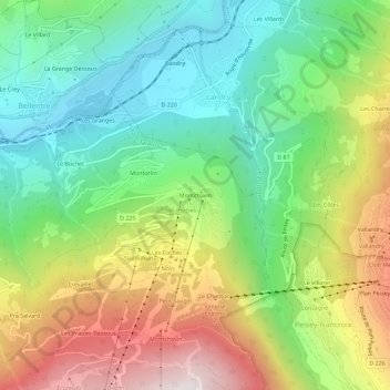
Name: Montchavin topographic map, elevation, terrain.

Location: Montchavin, Bellentre, La Plagne-Tarentaise, Albertville, Savoy, Auvergne-Rhône-Alpes, Metropolitan France, 73210, France (45.53989 6.71656 45.57989 6.75656)

Average elevation: 1,196 m

Minimum elevation: 711 m

Maximum elevation: 1,973 m

Other topographic maps

Click on a map to view its topography, its elevation and its terrain.

73210

France > Auvergne-Rhône-Alpes > Savoy > La Plagne-Tarentaise > Sangot

Average elevation: 1,766 m

Gear up for your next adventure:

🥤Hydration Bladders - Hands-free hydration systems for backpacks
🗺️Ordnance Survey Maps - Official UK maps for walking and outdoor activities
🛰️Satellite Messengers - Emergency communication devices for areas without mobile signal
🥾Trekking Poles - Poles to improve stability on uneven terrain
🛑Emergency Bivvy Bags - Heat-reflective survival bags for unexpected nights out

As an Amazon Associate, this site earns from qualifying purchases at no extra cost to you.