
Thank you for supporting this site ❤️
Make a donation
Make a donation
Gear up for your next adventure:
As an Amazon Associate, this site earns from qualifying purchases at no extra cost to you.
Kalimpong topographic map
Click on the map to display elevation.
Thank you for supporting this site ❤️
Make a donation
Make a donation
Gear up for your next adventure:
As an Amazon Associate, this site earns from qualifying purchases at no extra cost to you.
About this map
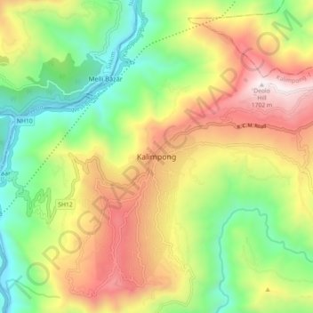
Name: Kalimpong topographic map, elevation, terrain.
Location: Kalimpong, Kalimpong -I, Kalimpong, West Bengal, 734316, India (27.03029 88.43237 27.11029 88.51237)
Average elevation: 834 m
Minimum elevation: 195 m
Maximum elevation: 1,683 m
Thank you for supporting this site ❤️
Make a donation
Make a donation
Gear up for your next adventure:
As an Amazon Associate, this site earns from qualifying purchases at no extra cost to you.