Geolocate

Adelanto topographic map

Click on the map to display elevation.

Adelanto

The average elevation of the city is 3,400 ft (1,036 m).

About this map

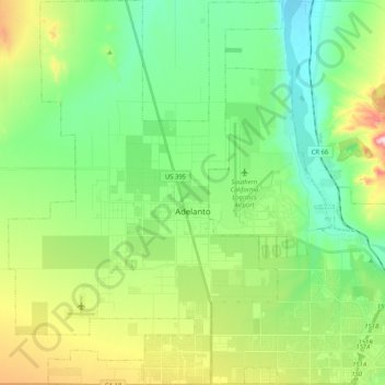
Name: Adelanto topographic map, elevation, terrain.

Location: Adelanto, San Bernardino County, California, United States (34.50649 -117.50745 34.67521 -117.36165)

Average elevation: 883 m

Minimum elevation: 767 m

Maximum elevation: 1,148 m

Gear up for your next adventure:

🧢Hiking Hats - Sun and weather protection for outdoor walks
🍳Camping Stoves - Compact stoves for outdoor cooking
🗺️Scratch-off Peak Maps - Track your progress climbing Munros or Wainwrights
🪓Outdoor Multitools - Versatile tools for hiking and camping
👖Convertible Hiking Trousers - Versatile zip-off pants for changing mountain weather conditions

As an Amazon Associate, this site earns from qualifying purchases at no extra cost to you.